Geography fieldwork trip takes Year 12 pupils from London to Dorset
22 May 2026
On Tuesday morning, a group of 17 pupils left a wet and miserable Holt for the annual Year 12 Geography fieldwork trip to London and Dorset.
LONDON
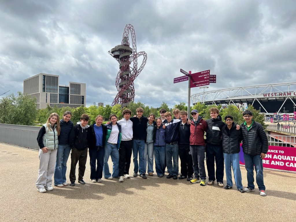
Our first day focused on London as a global city and the impacts of urban regeneration. We began in Stratford, the site of the 2012 London Olympic Games, where pupils explored the long-term regeneration and legacy of the Olympics. The group visited key locations including the stadium, the East Village, and different areas of the Queen Elizabeth Olympic Park, examining how the area has been transformed socially, economically and environmentally.
Throughout the day, pupils experienced a range of transport systems while travelling across the capital. From Stratford, the group headed to Liverpool Street to investigate London’s Financial District before moving on to Spitalfields and Brick Lane, where they were able to observe clear patterns of cultural identity and residential change.
The afternoon continued at King’s Cross, another major regeneration site, where pupils explored how former industrial land has been redeveloped into a thriving, mixed-use district. From there, the group travelled to Westminster and along the Embankment before taking a boat to Canary Wharf. Here, pupils examined the large-scale regeneration of London Docklands during the 1980s and considered the changing role of finance and globalisation within the city.
DORSET
After a full day in London, the group travelled to the Isle of Portland for the Dorset section of the trip. The Jurassic Coast is one of the world’s most famous coastal landscapes, providing an outstanding opportunity for pupils to experience coastal geography first hand.
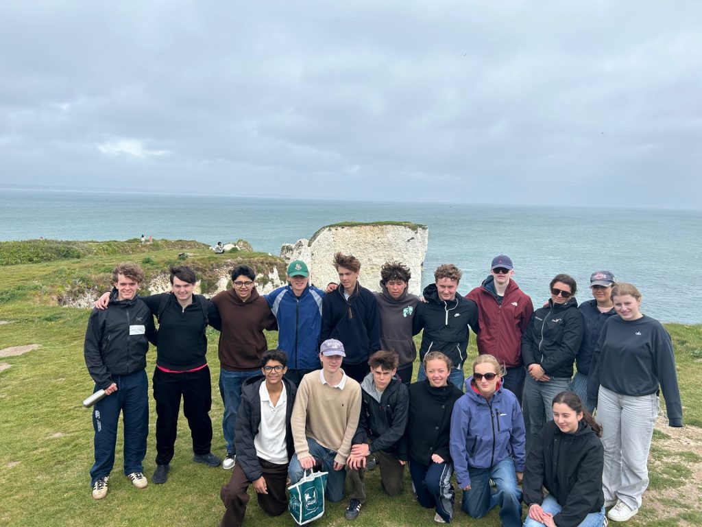
On Wednesday morning, the group travelled to Studland Bay to investigate dune succession, including vegetation zonation and the development of dune systems over time. This was followed by a walk to Old Harry Rocks, the iconic chalk stacks featured in many geography textbooks. Pupils examined the processes of erosion and weathering responsible for shaping the coastline and discussed the formation of headlands, bays, caves, arches, stacks and stumps. The walk then continued into Swanage, where pupils studied coastal management strategies and the impact of headland and bay formation on settlement and tourism. An open-top bus ride back to Studland provided spectacular views of the coastline before the group travelled to Kimmeridge Bay. Here, pupils explored the wave-cut platform, learning about the area’s geology and coastal processes while carrying out practical fieldwork activities on the shore platform itself.
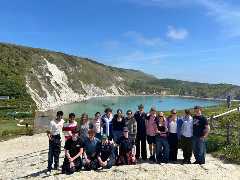
On Thursday morning, the group travelled to the top of the Isle of Portland to look down over Chesil Beach and study the formation of this famous tombolo. The group were fascinated to learn that Chesil Beach contains an estimated 180 billion pebbles and examined how longshore drift and coastal deposition have created this remarkable feature. The trip then continued through the Dorset countryside to Lulworth Cove, where pupils investigated the formation of the cove through differential erosion of resistant and less resistant rock bands. Nearby Stair Hole provided an excellent example of an early-stage cove formation, helping pupils understand how coastal landforms evolve over time.
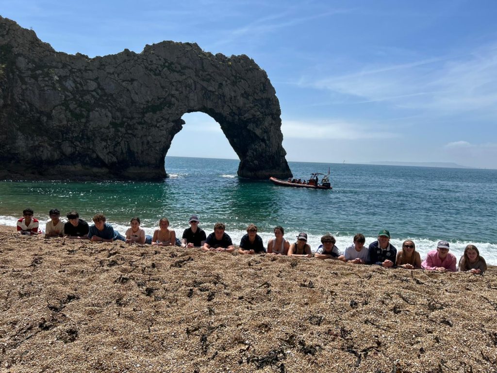
The final section of the trip took the group to Man O’ War Cove and Durdle Door, with beautiful weather arriving for the last afternoon. These spectacular coastal landscapes provided a fitting conclusion to the fieldwork experience and allowed pupils to consolidate their understanding of coastal processes and landform development.
This annual trip continues to be an invaluable opportunity for pupils to apply classroom learning to real-world environments and to build important knowledge and skills in preparation for Year 13 Geography studies.